
How lasers and volunteers are uncovering thousands of archaeological sites
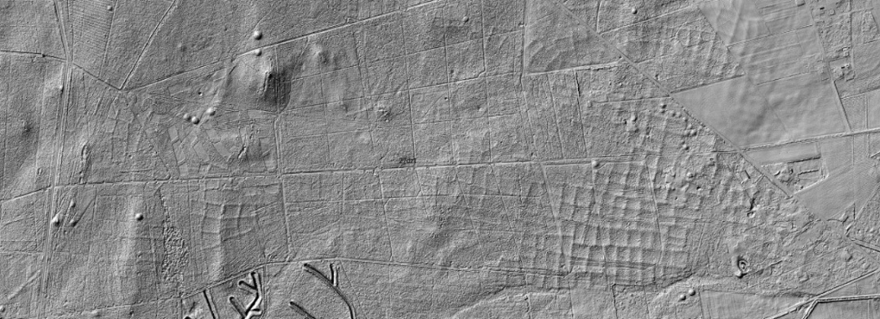
LiDAR, a laser-based remote sensing technology, is transforming archaeology by uncovering hidden landscapes beneath forests, vegetation, and shallow waters. Though initially designed for land management, its applications in archaeology have grown rapidly.
One striking example is ‘Heritage Quest’, a Dutch citizen science project led by archaeologist Quentin Bourgeois at Leiden University. Using AI and LiDAR data, volunteers identified thousands of potential burial mounds. With human verification, the project confirmed new sites with 90% accuracy. It mapped 2,000 km² in just three short months and demonstrated the power of combining technology with public participation.
Bourgeois emphasizes the value of human insight: volunteers often spot subtle patterns AI misses, such as Iron Age fields or burial mounds. Their contributions not only refine datasets but also help train future AI models for more accurate detection.
Read the full article in Le Monde (French). (€)