
Angkor region was actually a large Medieval city
The Greater Angkor Region in contemporary Cambodia was dramatically more urbanized in the 13th century than previously thought, and home to 700.000 to 900.000 people. These discoveries were made by a research team led by Sarah Klassen. Their findings are published in Science Advances.
"The level of urbanism at the medieval Khmer site was pretty unique for the world at the time"
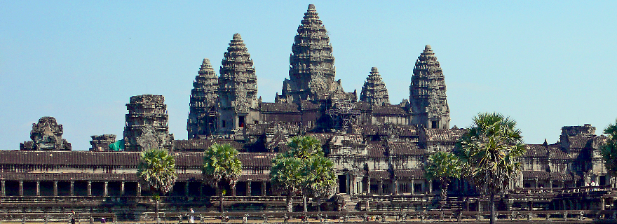
The Greater Angkor Region in Cambodia is known for Angkor Wat, one of the largest monumental temple complexes in the world. By combining several datasets and using new technologies such as Lidar mapping and machine learning algorithms, a research group lead by Sarah Klassen uncovered spectacular new facts about the region as a whole. "We now have data showing that the region, at its height in the 13th century, was home to 700.000 to 900.000 people. The diachronic maps also show the level of urbanism at the medieval Khmer site was pretty unique for the world at the time", says Klassen. The research was conducted in close collaboration with APSARA (Authority for the Protection of the Site and Management of the Region of Angkor).
Massive urban landscape
The research shows that Angkor Wat was actually just one feature of a massive urban landscape. The Angkor region was a Medieval city, that at its height supported a huge number of people. These findings dramatically change our understanding of the region. Diachronic maps, which were made using machine learning and sorting algorithms, show how the metropolitan areas of Angkor grew denser and larger over time. "In the 9th century, there was room for rice agricultural within what we consider civic-ceremonial centers. By the 12th century, these areas consist exclusively of house mounds and ponds, which also suggests that there was craft specialization and specialized labor in these areas."

Lidar proved to be ‘revolutionary’
The discoveries were made thanks to the fact that for the first time, datasets of various research projects could be combined into one database. The use of Lidar-maps (a 3D-point cloud of ground points that can be used to create digital terrain models) proved to be revolutionary, as the group was able to identify around 20.000 archeological features that weren’t previously mapped.
In the Greater Angkor Region there were around 1000 temple communities that are characterized by a central shrine. Machine learning helped by - as Klassen calls it - ‘incorporating all of the available data from the database,’ and using this data to understand chronological relationships among temples. Invaluable work, as before, only 10 percent of the mapped shrines had known dates.
Follow-up questions
These discoveries form the building blocks for a lot of follow-up research questions, such as: how did this city interact with the environment? Are there patterns in which the city developed? Are there analogies to the way contemporary cities develop? Thanks to the data now available, especially the number of people living in the area, the road is clear to explore some of these questions. Klassen hopes to pursue some of these questions in further research.
(Photo top: Angkor Wat, Sam Gerza Wikimedia Commons)
Text: Jan Joost Aten